Today had a lot more to offer than yesterday because I actually did important work for the company. Basically on I-95, there needs to be noise barriers because the road creates sound > 67 dBs on average. I went onto Google Earth and used the street viewer for literally miles of road to check for speed limit signs. I marked a pin and labeled their coordinates and location. That speed limit + 5 mph was added into the simulation (because nobody obeys the actual speed limit) so that TNM can calculate the average level of sound at each house for each build design.
Author: harrison_coman

Day 4

I did GIS training and sat in on a meeting.
Day 3 at SEPI (sorry everything deleted, incomplete)
Today I went out to do gather information, but unfortunately, the waters were too turbid to look for muscles, but I still did learn a lot about muscles. I learned about how they filter and reproduce. I learned that some species actually mimic small fish so that bass bite and then the babies latch onto its gills so that the bass will transport the babies to a different part of the stream and also give them food for a bit via their bloodstream.

Instead of the survey, we walked around the lake and I learned about how they perform wetland surveys. They get an augur and take out a small chunk of the soil to test for aquatic soil and such. I saw some of the wetland type vegetation and bugs. The bald cypress tree was an example of these vegetation.

That is an example of a stream that only fills during rainfall which could definitely be restored.
There is also this concept of no net loss which is legal required by the government. Basically, if you destroy or impact a stream, you have to create an equally positive impact or restore a stream.
The GISt of day two
The title is a pun, and not a very funny one, but I shadowed John in a meeting, a webinar, and learned a lot about GIS (geographical information system). GIS in the most simple way is just like Google Maps, but it has layers that are much more important than that.

SEPI does so much with GIS for so many different things such as representing roads, but what I respect the most about the company is its focus on minimizing impacts. I heard the term impact over and over at the company because it is such a versatile term with much meaning. One definition of an impact has to do with noise; there is a specific threshold of sound (67 dBs) that the government says houses cannot be louder on average. That is modeled with TNM. Impact also has a lot to do with the environment and the impact that we have on it and SEPI does their best to limit that.
Harrison – Day 1 at SEPI
When I saw environmental on the first day of my schedule, I didn’t know what to expect, but I do know that whatever it was, this was not it. As it turns out, environmental engineering encompasses many many things and a lot of paperwork and reports. I started with the paperwork.
The basic idea behind what I was filling out was demonstrating that the lines drawn on the GIS (geographic information system) (using arcGIS) were the actual boundaries between the wetlands and uplands. For something to be considered a wetland it had to meet three criteria: it must contain hydroponic plants, hydronic soil, and wetland hydrology (saturation of the water at a level of sufficient frequency and duration to support hydroponic plant life). This criteria must be mapped out and checked in the field, or rather the wetland, and documented in forms which because the data exists and its location is marked helps in construction near the area as well as helping preserve the life. I marked the coordinates from the GIS and put that on the form along with all of the rest of the information.

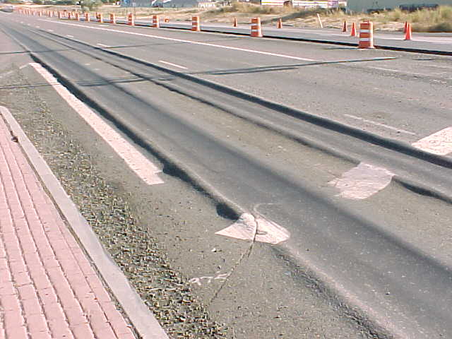
After that was done with that part, I moved onto reading into the basic information for the asset meeting about concrete. I learned way more about asphalt than anyone should ever know. I learned all the ways that asphalt wears down: stress cracks, transverse cracking, rutting, (there was one where the road becomes more of a lighter gray color and the aggregate is showing), etc. Stress cracks occur because of the weight of the cars driving over the road and over time, cars will wear down the road and then from the bottom upwards there will be cracks

Transverse cracks are more interesting because they can occur without any cars driving on them at all. They occur because of temperature changes that cause the whole road to slightly expand or contract. These small changes can damage the structure a little bit, but since the road is so big, there will be frictional forces from distances away trying to resist that expansion and contraction all building up upon each other needing some relief and that stress is released with that crack. This is often called block fractures because they tend to occur in lines. That is also why they are called transverse cracks.

Rutting is a common failure of asphalt that is quite similar to stress cracking, but doesn’t necessarily need a crack to occur. Vehicles tend to travel in one line and all of the wheels tend to go on that one line. Every time a vehicle passes by, the asphalt will deform a little bit causing a tiny divot. Over time, this creates a rut.
Next thing that I did was look at this construction map. This doesn’t need much explanation, I just learned a bit about what it means, how it works, and why it exists.

The final thing that I did was use a simulation to simulate sound and I looked at a project used to limit sound so that the city isn’t sued due to a disturbance. Basically in residential areas, the highway cannot cause over about 66 dbs of sound since that is the equivalent of a lawnmower all the time.
Work Experience Program
This is a test post just to make sure that everything is working.